Region: Northern Sierra
Distance: 8 miles
Elevation: 5,800 to 7,800 ft
Vegetation: Pine Forest
Last Visit: Mid July 2019
 |
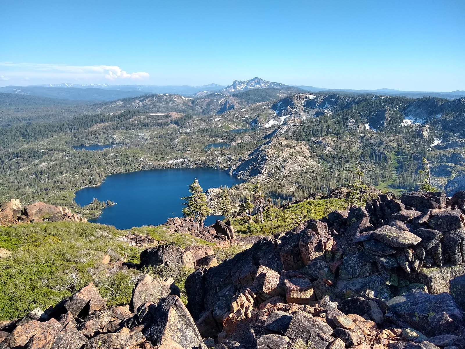
| Mt Elwell Summit Panorama |
Mt Elwell is a minor Sierra Peak at the southern end of the Plumas National Forest. While it's not particularly tall, it still commands an excellent view of the surrounding alpine lakes in the Lakes Basin Recreation Area and the taller peaks of the
Sierra Buttes about 9 miles to the south. If you're just going for views Sierra Buttes is more impressive, but I found Mt. Elwell more pleasant. The scenery is nicer, the trails less crowded and there aren't any ATVs or dirtbikes taring around nearby. Also instead of the out and back up Sierra Buttes, there are several options to loop over the summit of Mt. Elwell and visit one or more beautiful lakes along the way.
Rules
This hike is in the
Lakes Basin Recreation Area of the the Plumas National Forest. Dogs OK off leash under voice control. In general, backpacking is pretty easy in the Plumas NF, without much red tape, but the in Lakes Basin Area camping is not allowed between Mt. Elwell and Gold Lake except in the developed camprounds near trailheads. There are several in the area, a mix of reservable and first-come-first serve. Backpacking is allowed without any permits just north of Mt. Elwell between Smith Lake and Ward Lake. We actually camped at Smith Lake for this trip. There are two good campsites on the southern side of the lake. As always a
California Fire Permit is required to build a campfire or operate a camp stove in the backcountry.
Trailhead
We started at the Smith Lake Trailhead, on a short dirt spur off the road to the Grey Eagle Lodge from the Gold Lake Highway. No parking fee. Pit toilet but no garbage service.

Route
CalTopo Map:
https://caltopo.com/m/E1F4
We took a route starting from the Smith Lake Trailhead because we wanted to camp at Smith Lake, but a similar route could also star from the Lakes Basin Trailhead a mile or two south on the Gold Lakes Highway. We took the loop counter-clockwise hiking over Mt. Elwell from the north and descending to the south and hiking along Long Lake. That was definitely the right direction for us. The trail up the north side is more gentle and more shaded so better for an ascent on a warm summer day. The trail on the south side is steeper and more open with more views. We ran into some snow just below the summit on the north side which almost turned us around, though, so early in the summer you'd probably want to take the loop clockwise and climb the peak from the south to ensure you make it.
 |
| Elevation profile for the Mt. Elwell Loop |
 |
| Topographic Map of the Mt. Elwell Loop |
 |
| Maiden Lake, the largest of a string of ponds on a flat portion of Elwell's northern slope. |
 |
| Late July snow on the north side of the summit. |
 |
| The rocky summit. The last 30 feet or so were a challenge for our whippet to navigate. Smaller dogs might need to be carried. |
 |
| Long Lake and the Sierra Buttes from the summit. |
 |
| Jamison and Rock Lakes from the summit. |
 |
| Adding an entry to the summit register. |
 |
| Hanging out at the summit. There's a great little sitting area at the very top. |
 |
| Long Lake from the trail along it's northern shore |
 |
| A small cascade along the Long Lake Trail back to the trail head. |


No comments:
Post a Comment