Saturday, November 19, 2016
White Hill
Near: Fairfax
White Hill is a modest highpoint in Marin County near Fairfax. While the peak it's self is somewhat unremarkable, it does offer fine views of Mt. Tam and San Francisco to the south and across the San Francisco Bay to the east. The route up to the peak runs through a surprisingly varied landscape including a couple small stands of dense redwoods mixed in with typical Bay Area oak, chaparral, and grassland.Wednesday, November 9, 2016
Sierra Buttes
Near: Sierra City
Length: 7 miles
Elevation: 6,200 - 8,600 feet
Vegetation: Pine Forest
Last Visit: 11/05/2016
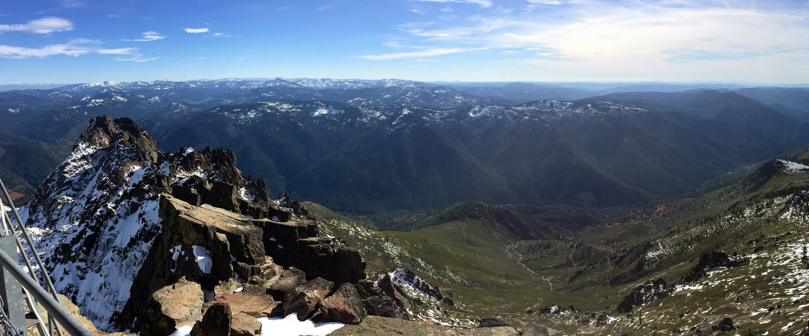
The Sierra Buttes are a dramatic cluster of volcanic spires at the northern edge of the Tahoe National Forest. Somewhat off the beaten path of the Lake Tahoe and High Sierra around Yosemite to the south, the Sierra Buttes are one of the most under rates spots on the Pacific Crest. An old forest service fire lookout sits at the summit, 4,000 feet above Sierra City and the Yuba River to the south and over 2,500 feet above the Sardine Lakes to the northeast with excellent views in all directions. There are a few options for climbing the summit, including a long climb up the south and west face from Sierra City along the PCT, and a few options converging on the north ridge. In the summer a 5 mile round trip is possible from Butcher Ranch Road above Packer Lake Saddle. We opted for a 7 mile route from near Packer Lake north east of the summit and passing Tamarack Lakes en route to the north ridge.
Subscribe to:
Posts (Atom)