Wednesday, December 30, 2020

All Good Things Must End


Well, they say all good things must end.  Does this mean Norcal Dog Trails was a good thing?  Meh.  Based on my stats it looks like very few people ever found this blog of much interest.  Either way, it's ending. We're off to new adventures back east and this blog is getting mothballed. Bumbling around California with a dog and the girl he owns for sevenish years definitely was pretty great though. 

Hopefully the hikes listed on the Hike Me First and Hike Me Next pages will help some folks find some great places to get out with their dogs in California.  Those pages are the best distillation of my favorite hikes.  Please take note that trail conditions can change fast, as the massive wave of fires this fall showed quite dramatically. So always check the official websites of the national forest service or appropriate park service for updates before going out on the trail.  All Trails is getting to be a pretty good source of trail condition updates too, through sheer usage numbers.

Have adventures. Be safe. Be polite. Clean up after yourselves. And please please please don't leave the dog at home to miss the fun!

Tuesday, December 29, 2020

Four Lakes Loop Deluxe

Near: Weaverville
Distance: 33 Miles (3 Days)
Elevation: 4,700 to 8,200 feet
Vegetation: Pine Forest
Last Visit: October 2020

The summit of Siligo Peak and Sawtooth Peak in the background.

The Four Lakes Loop is probably second only to the Canyon Creek Lakes as the headliner hike of the Trinity Alps.  The greater climb involved for Four Lakes keeps fewer people from doing this route than Canyon Creek Lakes, but because it's at higher elevation and melts out later. The shorter access window intensifies the crowding a bit in the mid-late summer.  We were out on a chilly October weekend and still saw lots of folks, so I would really advise avoiding summer holiday weekends on this route as competition will be fierce for the limited camping spots at the lakes.

The core of the loop is a ring around Siligo Peak, visiting four small lakes tucked in their own steep ravines. Many hike descriptions don't make this clear, but Siligo Peak is easily summited via a use trail from the ridge between Deer and Summit lakes and absolutely should not missed.  If you're short on time skip anything else, but not Siligo Peak. It's one of the most beautiful walk- up summits in California.

The hike described here is a 'deluxe' version of the four lakes loop. Really it should be called the '5/3 Loop' for five lakes and three peaks.  

Monday, December 28, 2020

Pleasanton Ridge Trail

Near: Pleasanton
Distance: 6 Miles
Elevation: 300 to 1,500 feet
Vegetation: Pasture and Oak
Last Visit: November 2020

Pleastanton Ridge is yet another East Bay cowpark.  Wide trails, a big climb and a few decent views of the Pleasanton area.

Sunday, November 8, 2020

A fire season like no other, or a taste of what's to come?

The charred remains of a lightning strike in the Ansel Adams Wilderness
 

As I write these words the first snowfall of the season is settling in over the Sierra Nevada and we can finally put the fire season in Northern California to bed.  SoCal... it seems that fire season is year round now, so no rest for the weary there.  In this season of counting - counting votes, counting coronavirus cases - it's time to count up the costs.  By all measures, this was a particularly intense fire season. According to the Center for Disaster Philanthropy, 4.2 million acres burned in California this year (more that twice the previous record), damaging over 10,000 structures and claiming at least 31 lives.  The financial costs of these fires is hard to fully quantify, but estimates in the tens of billions of dollars are common.  

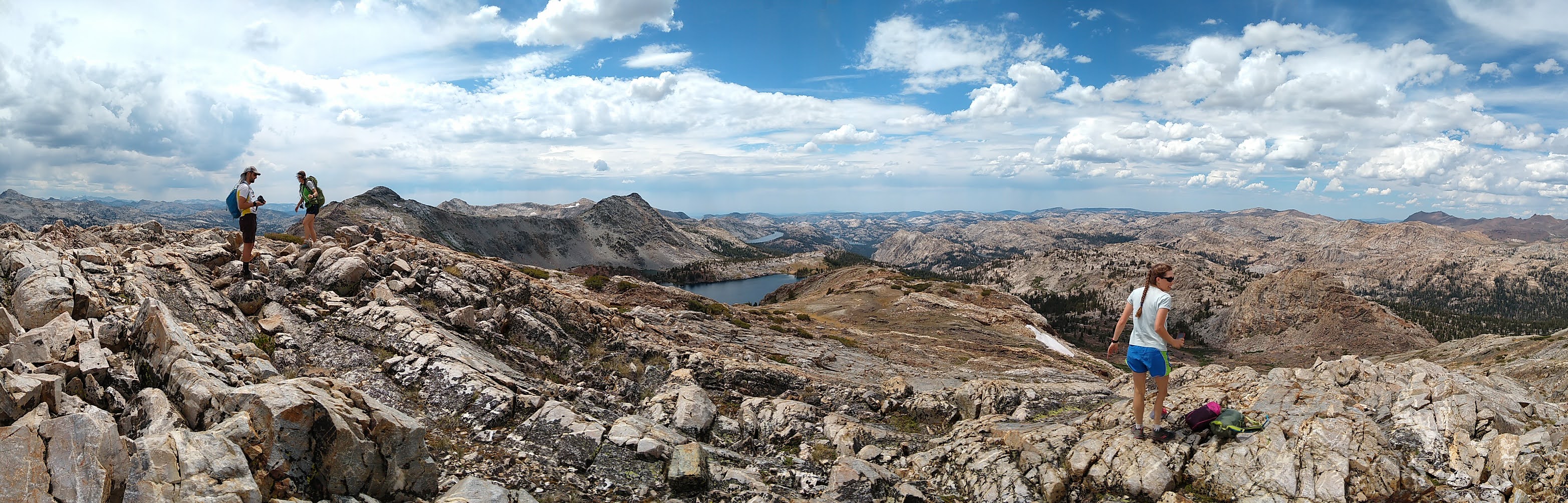
On a far less consequential note, of the 92 hikes currently described on his blog 12 have been burned by or were very close to major fires. This is the first year I can remember more than one or two hikes being affected by fire.  Not all fires are equal, with some being low intensity burns in in fire adapted areas, and others are extreme fire events, burning forests damaged by years of stress down to nothing.  All these hikes dramatically affected in one summer is a good reminder to always check local park and forest service resources before hitting the trails. Even recent trail descriptions can rapidly become out of date.  I'll put a notice on those blog entries, but each hike will have its own timeline for recovery.

For me the big question hanging from the 2020 fire season will be, was this a once in a lifetime summer, or a harbinger of the new normal?  There are two competing forces driving this question.  

 On the one side, we've mismanaged fire in the forest for around 100 years.  A fire suppressed is a fire delayed and a fire delayed is a bigger, hotter, more dangerous fire.  We built up a huge reservoir of fuel on the land, arming a bomb under our own feet.  Thankfully there has been a big change in the philosophy of fire management in our forest and fire fighting agencies, with a growing understanding that it's better to have as many small, low intensity fires as possible.  It's still very much a work in progress, but we're also finally starting to work out how we can include indigenous California tribes in our wildfire management.  On top of the change in attitude, all the huge fires in the past few years have really depleted the growing fuel backlog.  A cursory look at the lands burned in the past 20 years (and that doesn't even include 2020) shows that we're pretty far along in the turning over all that built up fuel.  If all else were equal, I'd be optimistic that we're at or near peak fire.

But all else is not equal.  Climate change likely means longer, drier, summers and more prolonged years of drought.  Already the stress on some California forests has made them more vulnerable to an invasive bark beetle infestation that has degraded large areas of forestland at mid altitude elevations.  The habitable zone for large conifer species is slowly creeping northward and up-slope.  I fear as the healthy forests retreat they're going to leave a trail of parched dead-fall ripe for explosive, dangerous fire events.  It was exactly this sort of situation that created the terrifyingly fast moving Creek Fire this year, the fire that set up a dramatic helicopter rescue of trapped hikers and boaters at Mammoth Pool and pumped so much ash into the air that it cast an eerie orange pall over San Fransisco.  Climate change seems to mean more fires like that, which is an unsettling prospect indeed. 


Hikes affected by major fires this year

Bay Area

Sunol Regional Widerness

Murietta Falls

Mariposa Point

Oat Hill Mine Trail 


Plumas National Forest

Grass Valley Bald Mountain

Feather Falls Loop


Sierra National Forest

Lillian Lake Loop


Sunday, November 1, 2020

Twin Peaks from Barker Pass

Near: Tahoe City
Distance: 10 Miles
Elevation: 7,700 to 8,800 feet
Vegetation: Pine Forest
Last Visit: October 2020


From Lake Tahoe, the Twin Peaks are just a pair of inconspicuous rocky lumps on the long ridge line running parallel to the west shore of the lake.  While they're only a couple hundred feet higher than the ridge, the final hundred feet of climb to the west peak is a fairly step ascent of a boulder pyramid overlooking a steep thousand foot drop to the north, making for an unexpectedly dramatic finish.  The summit provides excellent views in all directions with most of Lake Tahoe visible to the east, the Granite Chief Wilderness to the west and the higher peaks of the Desolation Wilderness in view to the south.  If you do take a dog on this hike I strongly recommend bringing a harness with a good hand hold (and be fit to use it on steep, rocky ground) as many dogs will need a lift or two on the final climb.

Otherwise the hike from Barker Pass is smooth and easy with a few good views of Lake Tahoe along the way, although take note there is about 400 feet of back climbing along the route.  If that's too much up and down for you, the hike can be turned into an easy 3-miler with about 500 feet of total climb by stopping at rocky outcropping along the way in.  Note to get the full view from that outcrop will require a bit of scrambling as well.  Once again, bring a harness.

Monday, October 19, 2020

Upper Kinney Lake

Near: Ebbetts Pass
Distance: 3 miles
Elevation: 8,600 - 8,800 ft
Vegetation: Pine Forest
Last Visit: September 2020


Upper Kinney Lake is a short, easy hike from Ebbetts Pass. With just a couple hundred feet of climb and a trailhead starting over 8,700 feet in elevation, it's a great destination for a light afternoon hike for a lowlander looking to test their altitude tolerance before taking on a bigger challenge.  If you do this hike and still feel you've got some extra energy to burn off, you can take a dirt road and use-trail to the top of Ebbetts Peak, over looking the pass, for just an extra mile of hiking (though with 400 feet of climb, very steep at a couple of points).  While this hike is far from the most spectacular option in the Sierra, its location at on the narrow, winding and very scenic Hwy 4 above Lake Alpine keeps it far from crowds and traffic, a good counterpoint to more popular hikes around Lake Tahoe to the north or Yosemite National Park to the south.

Friday, October 16, 2020

Round Top from Carson Pass

Near: Carson Pass
Distance: 8.6 Miles
Elevation: 8,500 to 10,400 ft
Vegetation: Mostly shrub
Last Visit: September 2020


 Round Top seems like a good name for this mountain from a distance, but on the steep scramble to the summit it reminded me of nothing so much as what a laugh the Vikings must have had when they named Greenland.  The last few hundred feet of climb require sturdy legs and tolerance for a bit of loose scree now and then, but mostly its a fun and easy scramble that should be fine for any healthy mid-sized dog and fit person without any vertigo issues.  The view from the summit (and along the way) is outstanding, even if you happen to be out on a smoky September day as we were, making the hike feel a bit like a walk into Mordor.  I'd rate the view from Round Top above any other in the Tahoe area except the most prominent summits in the Desolation Wilderness.  While the last bit on the unofficial summit trail is quite steep, the rest of the approach from Carson pass is light and easy.  Round Top may be the easiest hard peak in the Sierra, if that makes sense.

Thursday, September 3, 2020

Quartzite Peak via Emigrant Meadow Lake

Near: Pinecrest
Distance: 36 Miles
Elevation: 6,300 to 10,400 feet
Vegetation: Pine forest and high meadows
Last Visit: August 2020

Quartzite peak is a broad peak along the boundary of the Emigrant Wilderness and Yosemite National Park. The views from the peak are outstanding with a great vantage over Emigrant, Bigelow, and Twin Lakes to the west and many dramatic peaks is Yosemite National Park to the south east.  You should only attempt this peak if you're comfortable with some off-trail travel.  Easy off-trail travel, but still off-trail. There is no official trail to the summit, but an old mining road is shown on some maps.  We found that road and followed it some of the way to the summit, but it's very faint and after a while it's just easier to go cross country up the open slope.

Getting to the final peak is quite a haul.  We did this trip as a three day backpack with a camp at Lunch Meadow and a long middle day with only day packs.  Another day or two would have brought down the intensity quite a bit.  Breaking the trip over more days would be easy to do with excellent potential camps at Relief Reservoir (that could get crowded on Friday/Saturday nights), Emigrant Meadow Lake, Grizzly Meadow, or Snow Lake. 

Take note that we saw many bow hunters out in the area around Bond Pass, the pass into Yosemite, so keep your pooch close in that area.  Also be ready to run into lots of horses and mules.  A pack station at the resort hauls people and their gear up to Emigrant Lake. I have never seen so many mules on any Sierra trail as here. We must of seen around 50 pack animals over the course of the weekend.


Sunday, August 30, 2020

Spine Ridge

Near: Moss Beach
Distance: 6 miles
Elevation 50 - 1200 feet
Vegetation: Coastal scrub
Last Visit: August 2020


The Spine Ridge Trail (aka Sully's Trail) is one of the few current access routes to the Rancho Corral de Tierra, and undeveloped chunk of the Golden Gate National Recreation area.  This is a new acquisition to the GGNR and building out the trailheads and official trail network will take many years likely.  Most of the trails now accessible to the public in the RCT have no good public parking options.  The Spine Ridge Trail at least is accessible via a dirt road that has space for a few cars to park.  The hike up Spine Ridge is much less nice than the nearby route up to the North Peak of Montara Mountain from Montara State Beach, but it's less crowded.  In theory you can reach that same sprawling ridge line from the Spine Ridge, but we haven't made it far up the trail (on our one visit we were turned around by worsening air quality from a bad season of summer wildfires as we hiked out of the marine layer).  It's also unclear to me how the rules work when crossing San Francisco Watershed land around the top of the ridge.  On the way into the trail you must pass through the Moss Beach Ranch / Ember Equestrian Center.  Please be respectful of private property and don't feed/pet the livestock.  (They have many signs to this effect around the ranch so I guess that's sometimes a problem).

Sunday, August 9, 2020

Pyramid Peak

Near: Placerville
Distance: 6 Miles
Elevation: 6,000 - 10,000 ft
Vegetation: Pine Forest to Moonscape
Last Visit: July 2020

Pyramid peak is a challenging day hike for humans, and the summit is particularly difficult for dogs.  There is no official trail up the mountain, but a well-worn use trail easily accessed from hwy 50 has become one of the more heavily used routes to any Tahoe area peak.  Because it was blazed by bushwackers, it's much more aggressive than most trails in the area, climbing around 4,000 feet in just over three miles. 

The finish is a fun scramble up 400 feet of jumbly boulders ranging in size from toaster ovens to refrigerators.  This summit is thus extremely challenging for dogs.  We think our whippet could have made it on his own when he was younger, bounding from rock to rock, but we ended up carrying him more than half the way up and most of the way down, which was quite tiring I can tell you.  Carrying a whippet up a flight of stairs is one thing.  Carrying one up a 400 foot tall pile of uneven boulders with lots of opportunities to slip and fall while you're feeling weak from a steep hike up to 10,000 feet is a different thing.  Doing that with a larger dog would have been hell. So don't start the summit section unless you're a strong hiker and confident you can carry your dog out, because if the bounding from rock to rock is too much for them they could really hurt themselves here. Exercise caution! 

If this sounds too much for your dog, but a steep dirt ramp up to 10,000 feet sounds fine, you can still hike up to the base of the boulder pyramid and circle around to the northwest shoulder of the peak without any significant scrambling.  From there you gain an excellent view of Mt Price and the cirque above Sylvia Lake.  I do advise making the summit if you can, though, perhaps taking turns with a hiking partner with one munching on snacks and waiting with your dog down at the base of the pyramid, while the other scrambles up and takes it in for a few minutes.  In my opinion, in the whole of the Lake Tahoe Basin, the only equal view to summit's panorama over the Desolation Wilderness is the view over Lake Tahoe from the top of Mt Tallac.

Friday, August 7, 2020

Lillian Lake Loop

Near: Fresno
Distance: 12 miles
Elevation: 7500 - 9000 feet
Vegetation: Pine forest
Last Visit: July 2020


**Note: the Ansel Adams Wilderness was heavily impacted by the Creek Fire of 2020.  Check the Sierra National Forest website for up to date information on trail closures.** 
 
You really can't go wrong in the Ansel Adams Wilderness.  We usually access the Ansel Adams from the Bishop side of the Pacific Crest, but there's a huge chunk of it more easily accessed from the Fresno side.  I'd been eyeing a trip into this area for a while when wildfires pushed us off our planned route and some calling around turned up the last two open spots on the quota from the Fernandez trailhead on the Lillian Lake Loop.  We were quite pleased with our 'misfortune'.  This loop is doable as a day hike but makes for a nice moderate backpacking loop too.  The loop passes directly by two excellent alpine lakes and close enough for short side trips to three more.  While the loop doesn't hit any peaks or high passes, several spots along the trail afford wide views to the northwest.  I highly recommend making the detour to Chittenden Lake as the lake is very nice and the rocky benches on it's southern side afford the best views of the hike.  The best camp sites are around Lillian Lake, which also makes a convenient staging area for day hike to Rutherford Lake and/or Fernandez Pass to the north.

Monday, June 22, 2020

Silver Lake to Spanish Peak

Near: Quincy
Distance: 7 miles
Elevation: 5800 - 7000 feet
Vegetation: Pine forest and manzanita scrub
Last Visit: June, 2020


 **Note: this hike is very close to the by the North Fire Complex of 2020.  Check the Bucks Lake Wilderness website for up to date information on trails** 
 
Spanish Peak is a rather modest high point along the Pacific Crest in the Bucks Lake Wilderness, but the eastern flank of the peak is comprised of steep cliffs dropping a few hundred feet to cluster of small lakes. So even though it's low and mostly treed, the views are actually quite excellent. This route starts at the Silver Lake Campground on the lowest, largest of these lakes and climbs the steep rocky slope the the Pacific Crest.  I also recommend the side trip to Gold Lake, the prettiest of the four small lakes in the area.  Gold Lake is a popular overnight camping spot.

Grass Valley Bald Mountain

Near: La Porte
Distance: 4.5 Miles
Elevation: 5,000 to 6,250 feet
Vegetation: Pine Forest
Last Visit: June 2020


**Note: this hike was very close the to North Fire Complex of 2020.  Check the Little Grass Valley Recreation Area website for up to date information on trail closures.
 
Grass Valley Bald Mountain is a minor peak overlooking the Little Grass Valley Reservoir.  It's definitely not the most spectacular peak in the Sierra and I wouldn't make it your sole destination on a day you're driving a long way to hike a Sierra peak.  If you happen to be hanging about the reservoir or generally in the area, it does make for a nice moderate hike with a good balance of pay-off for the effort.  It's also one of the nicer low-elevation options in the Sierra, topping out around 6,250 feet so if you're getting impatient waiting for snow melt in the spring, it might be a good peak to start with.

Monday, June 15, 2020

Vargas Plataeu

Near: Freemont
Distance: 3.5 miles
Elevation: 900 to 1200 feet
Vegetation: Pasture
Last Visit: June 2020


Vargas Plateau Regional Park is yet another East Bay cowpark situated east of Freemont.  This post is for a moderate loop around the high portion of the park.  You can also hike up the steep trail from subdivisions at the base of the plateau, but to the extent this lesser visit park has something unusual to offer, it's the the wide open views available with relatively little climbing from the upper parking area.  Also it's not clear to me if there is any public parking close to the lower entrance.

Saturday, May 30, 2020

Bartle Gap to Peak 6213

Near: Mt Shasta
Distance: 13 Miles
Elevation: 4,800 to 6,200 feet
Vegetation: Pine Forest and Manzanita
Last Visit: May 2020


Mt Shasta from Point 6213

The Pacific Crest Trail takes a long detour around Mt Shasta near the California/Oregon border.  Along the southern stretch of this loop is an oft-overlooked series of ridges that are mostly tree covered, but offer a few great views of Mt Shasta across the McCloud River Basin to the north and even a few peaks at Lassen Peak across the lower hills to the south.  Peak 6213 is one of the main high points on this ridge, with outstanding views from it's brushy, manzanita covered summit.  This route is doable as a day hike, or as an overnight trip.  If backpacking, beware that water can be hard to come by on the ridge in the summer.  While less sweeping than the views at Peak 6213, there are also some good views to be had at Mushroom Rock, which the PCT passes under en route to 6213, but be aware that reaching Mushroom Rock requires some painstaking bushwhacking through thick manzanita bushes. (See the route notes for more detail on our misadventure to Mushroom Rock).

Sunday, May 17, 2020

Feather Falls

Near: Oroville
Distance: 8 miles
Elevation: 2,400 to 1,400 feet
Vegetation: Deciduous/Pine Forest transition
Last Visit: May 2020


 **Note: this hike was impacted by the North Fire Complex of 2020.  Check the Feather River Ranger District website for up to date information on trails**

I wasn't ready for Feather Falls.  From the few pictures I'd seen, I didn't really get a good sense of scale.  I was expecting a pleasant but not that impressive set of low-elevation California falls like maybe Murietta Falls or Alamere Falls.  But unless you're in the Yosemite Valley, you're not going to find any more impressive falls than Feather Falls.  In the spring and late summer, a large creek drops 500 feet down a cliff face viewed from an unobstructed platform built about 500 feet away from the falls on a steep ridge.

This was both a pleasant and problematic surprise.  You see, for our first return to the mountains in the Covid 19 shelter in place of spring 2020... I chose these falls as our destination.  Some minor falls away from any well known state or national parks seemed like a good bet not to be too crowded.  If I had just looked at the frequency of postings on All Trails, I would have realized otherwise.  This is a VERY popular hike, with all the extra annoyance that entails.  (Pot smoking teenagers at the falls, lots of cell phone boom-boxing, etc).   Also there is a lot of poison oak along the narrow trail, which is also on a steep hillside near the falls.  So social distancing is near impossible.  (Not that anyone besides us even bothered trying).  So if you're not up for big crowds (or your dog is unexcited about a lot of close contact with dogs going the other way on the trail), I strongly suggest you avoid this hike on pleasant spring weekends.  If I had it to do over again I'd come on a cool, damp, early spring day.

Friday, May 15, 2020

Piute Pass

Near: Bishop
Distance: 10 Miles
Elevation: 9,000 - 11,300 feet
Vegetation: Pine forest to moon scape
Last Visit: November 2019


Piute Pass is a relatively easy (by the standards of the Bishop area) route over the Pacific Crest from the east.  The trail up Bishop Creek passes between the imposing peaks of Mt Thoreau and Mt Emerson, past a couple of alpine lakes, and emerges onto the wide expanse of Humprey's Basin.  This hike is pleasant, and the steep sides of the Bishop Creek canyon and surrounding peaks make for imposing scenery, but for me, the pass and Humprey's Basin were just a bit too barren for my aesthetic tastes.  I like me some rocky peaks, but they're best when contrasted with some shady forest and green meadows. Like much of the immediate area around Bishop, Piute Pass is really more of a desert person's jam.

Mammoth Crest

Near: Mammoth Lakes
Distance: 9 miles
Elevation: 9,000 - 11,300 feet
Vegetation: Mostly pine, some sandy open plateau
Last Visit: November 2019


The ridge line of Mammoth Crest, overlooking Lake George in the Mammoth Lakes area, is one of the most easily accessible high points in the High Sierra.   The high-point on this hike is very reachable by fit hikers, but this route is also a great starting point for less experienced hikers or those who want to take in the High Sierra, but are still working on the altitude acclimatization because there are several rewarding shortened versions of the hike. 

The first mile or so is a 700 foot climb up a ridge overlooking Lake George.  The trail switchbacks into the shade then back out to the ridge for nice views of the lake many times on the way up. Those views are well worth the effort.  There is an option to take in Crystal Lake just under the impressive spike of rock called the Crystal Crag with only a 3 mile round trip, and an option for a 4 mile round trip to the shoulder of the main ridge line which affords fantastic views of the Ansel Adams Wilderness and the cluster of peaks known as The Minarets to the northwest.  But if you can make it the high point atop the cliffs overlooking Hammil Lake is fantastic.  

We didn't have enough daylight on the November day we visited to attempt this, but it's possible to continue along the crest to beautiful Duck Lake and then loop down to Lake George from there.  I can see why that loop is very highly rated. Though from what we could see and by all reports the section between the crest and Duck Pass can be hard to navigate, so do not attempt it without a good map and route finding experience.

Thursday, May 14, 2020

Bear Lake

Near: Pincrest Lake
Distance: 6.5 Miles
Elevation: 7,100 to 7,700 feet
Vegetation: Pine Forest
Last Visit: November 2019


Bear Lake in the Emigrant Wilderness is a good destination for a relaxed day hike.  The fact that I thought the lake was very ho-hum is a sign that I'm getting spoiled.  It's a pleasant spot with some rocky minor peaks overlooking it.  I was a bit more excited to scramble around the rocky prominence above Bear Lake and the smaller Camp Lake the trail passes along the way.  From those spots you get some expansive views over the valley to the south and into the wilderness. 


Mariposa Point

Near: San Jose
Distance: 9 miles
Elevation: 1,500 to 3,000 feet
Vegetation: Pasture
Last Visit: Spring 2019


**Note: This hike was affected by the 2020 SCU fire complex. Check on official information for Joseph D Grant Park, for up to date information on the state of trails there** 

Mariposa Point is not the highest point in Joseph D Grant Park, near San Jose, but close, and it's the point with the most prominence.  At just shy of 3,000 feet it's one of the highest places in the San Francisco Bay Area that you can hike to with a dog.  There's no point with unobstructed 360 degree views, but the views at the point and at a few places along the high ridge leading to it are still quite good, particularly in the spring when the grass is green. 


Tuesday, May 12, 2020

Black Diamond Mines Preserve

Near: Antioch
Distance: 4.5 miles 
Elevation: 300 to 1,200 ft 
Vegetation: Oak and pasture
Last Visit: May 2020

Black Diamond Mines Preserve is another hilly grassy San Francisco East Bay cowpark.  Wide trails climb steep grassy hills with sparse oak trees.  The east-west running ridge running through the middle of the park has a nice combination of views of nearby Mt Diablo to the south, and the flat expanse of the Sacramento River Delta to the north and east.  Sadly my phone was dead on this run so no pictures. Make sure to bring water for yourself and your dog, this route is very exposed with only a few bits of shade up along the ridge.

Monday, May 11, 2020

Hilton Creek Lakes

Near: Bishop
Trip Type: Day Hike
Distance: 10 miles
Elevation: 9,700 to 10,300 ft
Vegetation: Pine and Aspen
Last Visit: October 2018

3rd Hilton Creek Lake

Sitting about avoiding Covid19, I found this old incomplete post for a hike to the Hilton Lakes (Hilton Creek Lakes on some maps) in the eastern Sierra near Bishop, CA.  The Hilton Lakes make a nice destination for a moderate hike without going too crazy on elevation, which can be a challenge in the area.  But all in all, a it's a bit less spectacular than some of the other hikes in the area from nearby trailheads to the south. 


Lake Aloha

Region: Lake Tahoe
Distance: 12 Miles
Elevation: 7,400 - 8,400 ft
Vegetation: Pine Forest
Last Visit: October 2019


The Lake Aloha basin is a truly unique piece of the Desolation Wilderness.  In a broad, sparsely treed, rocky bowl surrounded by high peaks, there was once a collection of small interconnected lakes (the Medley Lakes) separated by a maze of low rocky ledges.  In the early 1900s the outlet to the basin was dammed, forming Aloha Lake.  If you visit in spring or early summer the entire basin is a broad shallow lake, late in the summer or fall, the Medley Lakes re-emerge as Aloha Lake is drained to keep water higher in downstream lakes and keep the Echo Lake Water Taxi viable.  Either way, it's a beautiful spot and a popular destination for overnight camping trips or day hikes.