1. The High Sierra
 The High Sierra Region The High Sierra Region |
 Crystal Crag, near Mammoth Lakes Crystal Crag, near Mammoth Lakes |
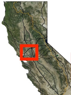
Definitions vary a bit on what exactly constitutes the 'High Sierra', but for our purposes this means the crest of the Sierra Nevada between Yosemite and Sequoia National Parks. Of course the most famous places in this famous region are all within the huge footprints of Yosemite, Kings Canyon, and Sequoia National parks, but there is so much awesome scenery to go around, even the 'leftovers' are still fantastic. Between Yosemite and Kings Canyon is a huge region of high peaks, alpine lakes and dramatic valleys bigger than those two parks put together. You will see a massive sequoia outside the parks now and then, and dense stands of pine are found in particularly wet valleys, but the big draw here is the constant sweeping vistas that the steep, rocky, dry terrain provides. Though the sparse summer rainstorms limit the vegetation, the massive annual snow accumulation maintains hundreds of idyllic alpine lakes and cascading creeks.
The choicest bits of this mountain playground are in the Ansel Adams Wilderness (which hugs the southern side of Yosemite) and the John Muir Wilderness (abutting the northern side of Kings Canyon). No roads cross the Pacific Crest in this area south of Tioga Pass in Yosemite, so trips into this area focus on the east side, originating from the I-395 corridor (Mammoth Lakes or Bishop) areas or the west side from Fresno area. One would think that the west side would be more accessible from the Bay/Sacramento, but the roads up from the central valley are so long and serpentine that it's a pretty similar drive either way.
With trailheads that range in elevation from around 7,000 to 10,000 feet, and peaks ranging from 10,000 to 14,000 feet, I advise lowlanders like us to work up to hikes in this region with some hikes in the lower Sierra farther north first, before going for a strenuous hike up here. And remember your dog is affected by the altitude too. When your schedule allows it, everyone will feel better if you can spend a few days acclimating to the altitude in the valleys before any strenuous hikes. Also be aware that this is one of the few places in California with enough mosquitoes to make a midwesterner reach for the mosquito netting. Peak Bug happens in July just after the snow melts out and decreases towards the end of the summer, so that's another incentive to spend the earlier summer at slightly lower altitudes and work up to the High Sierra in August and early September.
My Ranking of hikes in this area so far:
2. The Trinity Alps and the Great Wild North
 The Klamath Mountains, from the Caribou Lake Trail in the Trinity Alps |

In the far northwest of California lies a vast and mostly under-appreciated wilderness. The Six Rivers National Forest is tucked up against the coast and the Oregon Border, with the Klamath National Forest abutting it to the east. Sad to say I haven't spent much time in these forests, remote as they are from where I live. That remoteness and the steep, thickly forested river gorges that make up this region make for long, roundabout drives on narrow roads to some of the most isolated places in the continental United States. Here mountains higher than anything east of the Rocky Mountains tower over raging rivers, but few no of them let alone visit. The most accessible and well-visited part of these forests is the Marble Mountain Wilderness. I keep meaning to visit but still haven't made it.
Between the Klamath National Forest and the central valley is the Shasta-Trinity National Forest. Bisected by Interstate 5, Shasta-Trinity National Forest is much more accessible and boasts the highest peaks in the region. The most visible (and some of the most visited) places in the STNF are Mt Shasta, and the much lower, but dramatic Castle Crags looming above I-5. Most of the summit of Mt Shasta, and all of the Castle Crags are off limits to dogs, though. Dog lovers will need to go just a bit further from the main highway to the arc of jagged peaks stretching roughly 75 miles southwest from the city of Mt. Shasta to the town of Weaverville, directly west of Redding. The highlight of these minor ranges is the Trinity Alps.
The Trinities are a cluster of roughly 8,000 foot peaks rising abruptly above the scenic Trinity Lake, a large reservoir popular for boating and fishing. They are impressively jagged peaks, bisected by several fast-running creeks that cut steep canyons through thick pine forest. Waterfalls and cascades abound, as do scenic alpine lakes. The Sierra Nevada may surpass the Trinities in constant, sweeping views, but the Trinities feel more hospitable, with more plentiful water, air, and wildlife of all kinds. A few of the highest peaks are reachable as walk-ups, but most are so steep that some light rock climbing is required and thus no maintained trails reach them. Thus, headliner hikes of the Trinities mostly finish at high alpine lakes flanked by dramatic granite cliffs under the main peaks. The Trinities are also an easier venue to plan overnight trips than the Sierra, because while a wilderness permit is required to camp here, there are no entry quotas and thus reservations aren't necessary. The down side of that policy is that the most popular lakes and meadows tend to be covered with tents on long holiday weekends. You can find solitude in the Trinities, but that requires finding some its more remote corners.
My Ranking of hikes in this area so far:
3. Greater Lake Tahoe
 The Lake Tahoe Region |
 Lake Tahoe from the summit of Mt Tallac |
I don't need to explain Lake Tahoe to you. Ringed by ski resorts and casinos, Lake Tahoe is perhaps the most favorite all-around playground for the denizens San Francisco Bay area and Sacramento metro area, save perhaps getting sloshed in Napa and Sonoma. I've been told that Truckee's permanent population of around 16,000 literally doubles on weekends, though I can't seem to find any hard numbers behind that.
But what is 'Greater' Lake Tahoe? For me, that's the stretch of the Sierra Nevada running from Sierra City (about 30 miles north east from Truckee) south to Carson Pass (about 20 miles due south of Lake Tahoe). Economically, this area is dominated by the tourist economy centered around casinos and big ski resorts. All that tourism dough and relative proximity to San Francisco and Sacramento mean there are more well-maintained roads here than anywhere else in the Sierra Nevada. That ease of access means that many many excellent hikes in this are accessible as day trips from nearby cities, provided you're up for braving Tahoe traffic two ways in one day. That's not for everyone, but it works. Especially if you have a morning person to drive out, an evening person to drive back, and a dog that sleeps the entire way.
Geologically and ecologically the area is distinct as a slow ramp up to the High Sierra farther south. Sierra Buttes, looming over Sierra City, is the most northerly Sierra Nevada peak over 8,000 feet. Elevations slowly creep upward as you travel south to Carson Pass, where peaks over 10,000 feet are common. The tree cover generally spreads out as well at these higher elevations, slowly giving way to the more sparsely treed, drier, and slightly desolate forests of the higher valleys in the central Sierra and the rocky moonscape of the higher peaks.
The best hiking to be had here is around the south west corner of Lake Tahoe and the adjoining Desolation Wilderness. The peaks here boast outstanding views of both Lake Tahoe to the east and open rocky valleys and alpine lakes of the Desolation Wilderness to the west. The Desolation Wilderness is supposedly the most visited wilderness area in the country, but the vast majority of that foot traffic is from a few trailheads near the lake. Trips starting from the western side of the wilderness tend to be less crowded.
If you want to backpack in the Desolation Wilderness you will need to plan far ahead and reserve an entry permit at recreation.gov, or get to a ranger station early day-of to to get a walk-up permit because there are strict quotas on overnight trips from each trailhead in the wilderness. There are lots of good options around the region for trips with less red tape. The Mokelumne Wilderness on the south side of Carson Pass requires entry permits, but there are not quotas, so you can just waltz up to any ranger station on your way in. No permits are required to backpack in the Granite Chief Wilderness or the surrounding El Dorado and Tahoe National Forests.
There are only a few state parks in this area (mostly around lake Tahoe) that restrict dogs. Sugar Pine Point, DL Bliss, and Emerald Bay state parks on the California side of the lake are basically no-go for dogs outside developed campgrounds. Tahoe Nevada State Park on the Nevada side has some leash restrictions, but dogs are allowed on the trails. Some areas of the Granite Chief Wilderness are off limits to dogs from May 15 to June 15 to reduce disturbances to deer during fawning season.
There are only a few state parks in this area (mostly around lake Tahoe) that restrict dogs. Sugar Pine Point, DL Bliss, and Emerald Bay state parks on the California side of the lake are basically no-go for dogs outside developed campgrounds. Tahoe Nevada State Park on the Nevada side has some leash restrictions, but dogs are allowed on the trails. Some areas of the Granite Chief Wilderness are off limits to dogs from May 15 to June 15 to reduce disturbances to deer during fawning season.
My Ranking of hikes in this area so far:
- Mt Tallac
- Pyramid Peak (WARNING difficult summit for dogs)
- Ralston Peak
- Mt Elwell Loop
- Round Top (WARNING difficult summit for dogs)
- Twin Peaks (WARNING difficult summit for dogs)
- Desolation Wilderness via Wrights Lake
- Desolation Wilderness via Eagle Falls
- Sierra Buttes
- Lake Aloha
- Castle Peak
- Granite Chief
- Tells Peak
- Rubicon Peak
- Lake Winnemucca
- Mt Rose
- Glacier Lake
- Freel Peak
- Mt. Lola
- Loch Leven Lakes
- Martis Peak Lookout
- Genoa Peak
4. Ebbetts and Sonora Passes
 Ebbetts and Sonora Passes |
 Sonora Pass from the Pacific Crest Trail |
Between the Lake Tahoe area to the north and Yosemite National park to south is an often overlooked stretch of the Pacific Crest comprised of the Stanislaus National Forest on the west side of the crest and the Humbolt-Toiyabe National Forest on the east side. Without the huge crowds that Yosemite draws, or the casino and ski traffic of the Tahoe area the area has a much calmer, more rural feel. There are just two major access roads to this section of mountains, the slow, meandering state highways 4 and 108, which cross Ebbetts and Sonora Passes respectively. Both of these roads are snowed under for about half the year because they are impossible to maintain in winter, and serve as snowmobile and ski arteries into the backcountry during the spring.
This area includes four popular wilderness areas for hiking and camping: the Molekulumne Wilderness, the Carson-Iceberg Wilderness, the Emmigrant Wilderness, and the Humbolt Wilderness.
Both highways 4 and 108 pass popular (and often busy) alpine lakes as they enter the high country from the west (Lake Alpine and Pinecrest Lake), surrounded by campgrounds and resorts with lots of swimming and boating options. Pinecrest lake is the lower and more developed of the two (around 5,600 feet) and can be quite a madhouse in summer. Beyond these lakes, the crowds give way to winding scienic byways and less busy campgrounds and trailheads.
Both highways 4 and 108 pass popular (and often busy) alpine lakes as they enter the high country from the west (Lake Alpine and Pinecrest Lake), surrounded by campgrounds and resorts with lots of swimming and boating options. Pinecrest lake is the lower and more developed of the two (around 5,600 feet) and can be quite a madhouse in summer. Beyond these lakes, the crowds give way to winding scienic byways and less busy campgrounds and trailheads.
My Ranking of hikes in this area so far:
- Leavitt Peak
- Bull Run Peak
- Inspiration Point
- Bear Lake
- Pinecrest Lake Loop
- Wheeler Ridge
5. The Northern California Coast
 Northern California Coast Northern California Coast |
 |
6. The Golden Gate and Marin
 The Golden Gate The Golden Gate |
 |
Just north of San Francisco, Marin County boasts some very scenic coastline, with lots of scenic hillside hikes to few it from. Sadly though, like most of the coast, the best trails and beaches in this area mostly off limits to dogs. There is one nice set of trails between Rodeo Beach and Muir Beach (right smack in the middle of the Marin County coastline) that is open to dogs, though. There are actually a lot of dog hiking options further inland in Marin County, as most of the Marin County Open Space District parks allow dogs on leash. While there are some physically satisfying hill climbs in these parks, they're pretty short on ocean views. For the best combination of a prominent local peak and some limited ocean views, head to Mount Tamalpais, the 2,500 foot peak that dominates the area. While the lower southern and western slopes of the mountain in the Muir Woods National Monument and the Mount Tamalpais State Park are off limits to dogs, the upper half of the mountain is actually on local water district lands and open to dogs on leash. The single-track hiking trails and wide fire roads on the peak offer a few limited views of the Pacific coast, and many excellent views of the San Francisco Bay.
My Ranking of hikes in this area so far:
- Mt Tamalpais fire roads
- Rodeo Beach and Wolf Ridge
- Cataract Creek Trail
- White Hill
- Bolinas Ridge
- Big Rock Ridge
7. Plumas National Forest
 Plumas National Forest Plumas National Forest |
 |
The Plumas National Forest covers the low northern reaches of the Sierra Nevada approximately between California highway 49 in the south and Lake Almanor in the north. All things considered these are some perfectly nice mountains, but they suffer from being both less dramatic than the higher Sierra peaks to the south and harder to get to for most Californians. So most of us haven't spent much time there. Feather Falls near Oroville are some of the tallest falls in the continental US and make a great day hike, but be aware the trail can be very crowded. My favorite hikes in the area so far are the Mt Elwell / Sierra Buttes North area, but I really count that as part of the larger Lake Tahoe region. Spanish Peak and the small alpine lakes on its eastern side are very nice, and Grass Valley Bald Mountain is worth a visit if you're nearby.
8. Lassen National Forest
 Lassen National Forest |
 Lava flows in Lassen National Park Lava flows in Lassen National Park |
9. Ocean beach to Big Sur: The Central California Coast
 |
 |
10. The Sierra Nevada Foothills
 |
 |
11. The East Bay Hills and The Diablo Range
 |
 |
With the exception of a few patches of shady redwoods, the rolling heights of these hills tend to be covered with invasive grasses and strolling cows. In the summer they're hot, brown, and dusty. Poison oak is abundant. But for several months in the late winter and early spring, the grass is green and the temperatures are mild. During this time the unobstructed views over the rolling green hills from local high points can actually be quite beautiful. Handily this period tends to overlap well with early melt-out in the the Sierra and Trinity Alps, when the snow is getting unreliable for skiing, but it's hard to hike anywhere above 6,000 feet or so because the trails are hard to find in the remaining piles of slush.
My Ranking of hikes in this area so far:
- Redwood Regional Park
- Sunol Regional Wilderness
- Mission Peak
- Tilden Regional Park
- Murietta Falls
- Morgan Territory
- Briones Regional Reserve
- Pleasanton Ridge Trail
- Wildcat Canyon
- Joseph D Grant Regional Park
- Harvey Bear Ranch
- Vargas Plateau
- Garin Dry Creek Regional Park
12. The San Francisco Peninsula and the Santa Cruz Mountains
 |
 |
13. Modoc National Forest and the Warner Mountains
 The Modoc National Forest |
14. Napa and Sonoma Counties
 |
 |
15. Mendocino County
 |
 |
16. The Sacramento River Delta
 |
17. The Central Valley
 |
No comments:
Post a Comment