Near: Medford Oregon
Trip Type: Hike
Distance: 8.5 Miles
Elevation: 5,600 to 9,500 ft
Vegetation: Pine Forest to Moonscape
Last Visit: August 2017
 |
| Presto lounges at the McLoughlin summit. |
Mt. McLoughlin towers over Medford, Oregon just north of the California boarder. We hiked it as a side trip to break up the drive on the way the 2017 eclipse in the Bend area. It made for an unexpectedly nice hike with a fantastic summit. It's really two very different hikes in one. The first two miles are a gentle 1,000 foot climb in deep forest. The second two miles are an aggressive 3,000 foot ascent first to a prominent ridge, then up an increasingly exposed ridge of crumbling volcanic rock. High up there were some sections of crumbling rock and/or volcanic sands that require sure-footedness. We saw several dogs on the trail, but Presto was the only one we know made the peak. The steepness of some sections together with the rough footing may be a little much for some dogs (and humans). No climbing or scrambling is required, though, it's just a relatively challenging walk-up.
Trailhead
The Mt McLoughlin trail trailhead off of Forest Rd NF-3650. We accessed it from the east by taking route 140 to NF-3661 (Fourmile Lake Rd). It's about 3 miles north on NF-3661 then turn left (southwest) on NF-3650 for about 1/4 mile to the trailhead. The dirt road was in good shape and no trouble for our Prius. We used our
Northwest Forest Pass to park at the trailhead, but there is also a pay station for a one day fee. (something on the order of $5)
 |
| The Mt McLoughlin trailhead |
 |
| They're pretty worried about lost hikers |
 |
| I can't remember ever seeing such explicit "don't be an idiot" signage at a trailhead |
Rules and Regulations
Mt McLoghlin is in the
Sky Lakes Wilderness of the Fremont-Winema National Forest. No permits are needed for hiking or dispersed camping at least 100 feet from lakes and 50 feet from streams. Groups sizes are capped at 8. Signage on leash regulations was a bit ambiguous. A sign in the parking lot makes it clear leashes are required there at least, but didn't specify if that was true on the trail. Several hiking blogs suggest many trails in the are require leashes, but I can only find specific statements online for the Sky Lakes Wilderness that leashes are required in developed areas and the Forest Service website doesn't seem to have any information on leash rules generally. The safe option was to assume a leash was required on the trail, but we could never really verify if that was true.
Route
The trail heads straight uphill northwest from the trailhead and connects with the PCT in a little under a mile. Turn right on the PCT which quickly turns back northwest and stay left at the junction at a bit under 1.5 miles in. From here it's just a strait shot with no intersections. At a little more than 2 miles, the trail turns sharply steeper and maintains the agressive climb all the way to the top with only briefly more level sections. From this point on streamers on tree branches and occasional paint marks on rocks help mark the trail. It can get a bit confusing though, because in several places two or more alternative routes are marked. They mostly seemed equivalent, though, and get you where you're going.
As climb above 8,000 feet about 3.5 miles in, you crest the major ridge you'll follow to the summit. Make a mental note of this spot and visible streamers leading back down into the trees. Apparently lots of hikers returning from the summit leave the ridge too early and get lots on the southern face of the mountain. Having a good sense of where you gained the ridge should prevent any such troubles.
From here it seemed the most optimal route was mostly along the very top of the ridge, with a few detours around particularly steep rocks. We missed this most of the way up, though, because a parallel route just south west of the ridge was marked with streamers (probably just because it was easier to mark on the shrubby trees growing here). I can't help but think that the Forest Service would have to spend less time looking for lost hikers if somebody more clearly marked the route keeping to the top of the ridge and marked some clear re-directs back to the ridge from this lower route. Anyway, once you've gained the ridge, if you find yourself off the ridge for more than 50 yards or so, try to find a way back up to it. The higher you get, the tricker the footing gets with some sandy/loose talus bits near the summit. Take it slow and watch your ankles here. Our dog needed some extra encouragement up some of these bits and we put his booties on to protect his feet from the rough rock and sand.
The summit is a very nice pile of more solid rock with plenty of nice spots to laze about and enjoy the view. Once you've soaked in the scene, return down the ridge. Making sure to keep Fourmile Lake in view to the northeast (that is keep to the ridge) until you reach the departure point you took note of on the way up.
CalTopo Map:
https://caltopo.com/m/A2DJ
 |
| Elevation profile for the Mt. McLoughlin trail |
 |
| Topographic map for the Mt. McLoughlin Trail |
 |
| The Mt McLoughlin trail as it leaves the PCT |
 |
| Mt Shasta peaking through the clouds to the south. |
 |
| Wizened old pine tree near the point the trail gains the southeast ridge. Whitebark pine? Limber pine? Juniper? I need to work on my mountain botany. |
 |
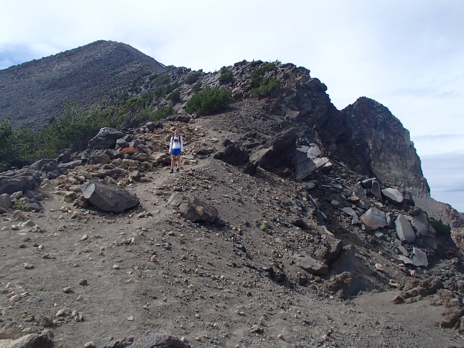
| Looking up the ridge towards the summit |

 |
| Fourmile Lake from the ridge. |
 |
| Fourmile lake again beyond a prominent volcanic butress. |
 |
| Looking back down the ridge |

 |
| The summit panorama |


No comments:
Post a Comment