Near: Yuba Pass
Trip Type: Day Hike
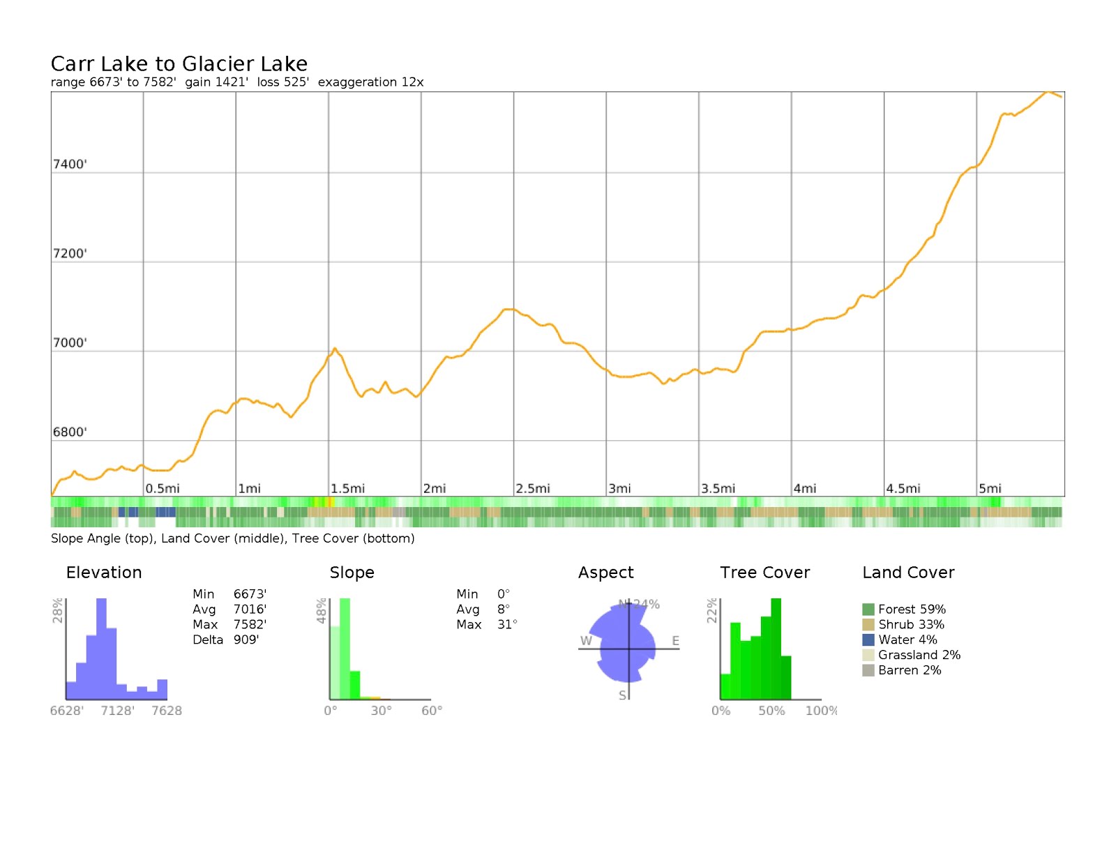
Distance: 11 Miles
Elevation: 6,700 - 7,600 ft
Vegetation: Pine Forest
Last Visit: 9/24/17

Recently Lori was nursing a sore hip and we went looking for some nice mountain scenery that we didn't have to climb much for. The Round Lake and Glacier Lakes trails fit the bill. With only a few hundred feet of climb, the Round Lake trail runs by or near five small alpine lakes in just a few miles. Lori was doing OK, so we ended up extending all the way to Glacier Lake for a respectable distance and climb in the end but it was nice to have such a scenic easy option. I think this area would be a great place for an intro backpacking trip, as it's got lots of picturesque camping spots that are attainable without much climb and manages to feel satisfyingly remote even though it's just a short drive from I-80.
Rules
This hike is in the
Tahoe National Forest. Dogs are allowed off leash if under effective voice control. Please pick up after your dog and carry out all refuse. There are no permits required for hiking or back country camping. A
permit is required for campfires or use of campstoves.
Trailhead
Forest Road 17 (accessed via Bowman Lake Road) near Carr Lake Campground. Bowman Lake road is paved, Forest Road 17 is a moderately rough dirt road. The prius made it up OK with some careful maneuvering at a couple points. So a high-clearance vehicle would be convenient, but not necessary unless the road deteriorates further in future years.
Route
Take the dirt road around the north side of Carr Lake to the dam at the base of Freeley Lake. The Round Lake trail then rolls over some modest climbs past Freeley Lake, the Crooked Lake Trail, Island Lake, Island Lake, Round Lake and Milk Lake and ends at Grouse Ridge Trail at about 2.5 miles in. Continue north east on Grouse Ridge Trail as it descends a bit for half a mile. At the next intersection bear right onto Glacier Lake Trail. There is another intersection soon after this and you have the option to divert onto the Sand Ridge Trail, which gives an alternate route to Glacier Lake. We just continued up Glacier Lake Trail which settles into a sustained, but moderate 600 foot climb to Glacier Lake over the next couple of miles. Glacier Lake is in the shadow of some small but steep rocky buttes (the Black Buttes) which looked relatively easy to scramble for some nice views, though we didn't explore them as they were a bit snowy and Lori was nursing a sore hip back to full health and not up for a steep, slippery scramble. As it is the views from the north end of the lake are plenty nice without an extra exploring.
CalTopo Map:
https://caltopo.com/m/KA99


 |
| Island Lake from the Round Lake Trail |
 |
| Round Lake |
 |
| Glacier Lake with the Black Buttes behind |
 |
| Glacier Lake and the view north from a rocky overlook near the north outlet. |
 |
| Looking north into the Five Lakes Basin with English Mountain behind and the Sierra Buttes in the distance. |


No comments:
Post a Comment