Near: Echo Summit
Length: 7 Miles
Elevation: 6,400 - 9,200 feet
Vegetation: Pine Forest and Scrubby Meadows
Last Visit: November 2018
 |
| The summit of Ralston Peak overlooking Ralston, Tamarack, and Echo Lakes with Mt Tallac and Lake Tahoe in the distance. |
Ralston Peak is one of the best 'bang for your buck' hikes in California. The trailhead is right on US 50 between Kyburz and Echo Summit, making it a relatively direct drive. It's a nearly 3,000 foot ascent to the summit, but the trail doesn't mess around, reaching the peak in under 4 miles (actually just 3 miles if you take a more direct use-trail on the final climb). The summit is easily reached without any rock scrambling and provides fantastic views in all directions. Given all that, I'm a bit surprised this trail isn't completely overrun with hikers. Likely the steep ascent and a lack of many views on the lower slopes keep away most of the less energetic crowd, opting instead for the often crowded Horsetail Falls trail nearby. The falls aren't visible from the summit, but we found a secret overlook just off the trail from which you can just see them.
Rules
This trail is in the
Desolation Wilderness, part of the
Eldorado National Forest. Dogs can be off leash if under effective voice control. Overnight camping requires a wilderness permit and quotas are in place, so reserve far ahead of a trip on
Recreation.gov if you want to backpack. Even day hikes require a permit in the Desolation Wilderness. Usually these day-use permits are available from self-registration stations at most trailheads. However, if you show up in late fall to late spring, they may be taken down for the winter (as we found when we arrived). In that case you can plan ahead and stop at an Eldorado NF ranger station (there's one in Pollack Pines on US 50). We didn't realize this and called in the ranger station when we found the sign instructing all hikers to register and warning of fines if caught without a permit, we were told to just hike on in. Apparently the sign was supposed to be covered up and the rangers don't enforce permit rules during the winter season.
 |
| Information sign where the self-registration station usually is in summer. |
Trailhead
A pullout on US highway 50, about six miles west of Echo Summit. When approaching from the west you will pass the trailhead for Horsetail Falls and the road will take a wide sweeping curve to the right as you climb steeply with dramatic views off to your right. As you reach the top of this climb, the road turns sharply left. The trailhead is visible on the left of the road almost immediately after this sharp turn as the road levels out. The trail proper starts about a quarter mile up a dirt road from this main parking area with a large sign and self-registration box (well, in the summer, see rules above). There is room here for a few 4WD vehicles to park.
 |
| Main parking area for the Ralston Peak trail. |
Route
The trail climbs pretty aggressively for the first two miles, then crosses over a minor nub of a ridge just under 8500 feet. At this point you can choose to turn right and follow a use trail directly up to the summit, or continue on the official trail as it looses a few dozen feet of elevation then climbs more slowly as it loops around to climb the peak from the north side. A good argument for staying on the official trail is that you get more trail time with excellent views to the east for the last half mile as climb the north ridge. On the other hand you could just power up the use-trail and spend more time lounging at the summit.
I have one big addendum though: the trail setters really screwed up about half way up by, bypassing a great overlook with views of Horsetail Falls, Lover's Leap and the South Fork American River gorge. To find this overlook requires some bashing through thick underbrush, but it's worth it. Watch for the point when reach a slightly more exposed section and you first sight Pyramid Peak to your northwest. At this point the trail turns sharply east to avoid plunging off a cliff. Instead turn left here and follow the ridge to some large rocks you can just see through the trees. Here you will find a sudden and dramatic drop-off with a great view. I have marked this spot on the maps below.
CalTopo Map:
https://caltopo.com/m/43CH


 |
| First view of Pyramid Peak as the trail makes a sharp right. Look left here to find the secret overlook. |
 |
| Looking down towards the secret overlook. Make your way carefully through the thick underbrush towards the large boulders and watch out for the drop-off. |
 |
The view from the secret overlook. You can't quite see Horsetail falls here, but if you go out to the very end of a big rock on the cliff, you can just see the falls around a large cliff face to your right. The view at the top is better of course, but I'm baffled as to why this overlook isn't more directly accessable from the trail.
|
 |
Trail junction north of the summit. There is a trail here not shown on some forest service maps that follows the north ridge down to the Aloha Lake basin. That could make for a nice alternative route up Ralston included in a backpacking trip into Lake Aloha from Echo Lake.
|
 |
| The trail ascending the last section along Ralston Peak's north ridge, with Ralston Lake and Tamarack Lake visible below. |
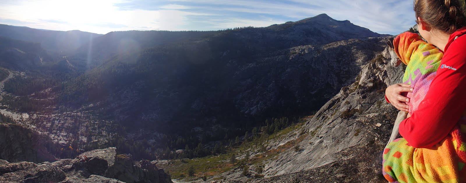
 |
| The summit panorama. |
 |
| There is a logbook at the summit. |
 |
Looking north towards Aloha Lake from the summit.
Left to right: Pyramid Peak, Agassiz Peak, Mt Price, Little Pyramid, peak 9405, Jacks Peak, and Dicks Peak. |


No comments:
Post a Comment