Near: Sonora Pass
Distance: 11 miles
Elevation: 9,500 - 11,500 ft
Vegetation: Moonscape
Last Visit: July 2014
At 11,500 feet, Leavitt Peak isn't quite the true High Sierra, but it's getting there. If I'm not mistaken, there isn't a taller peak to the north of it all the way to Mt Shasta. Situated along the crest just south of Sonora Pass, it's eminently reachable in a day hike. A couple thousand feet of elevation gain in thin air make this a hard climb for those of us coming up from sea level. The terrain is gobsmacking in that stark Sierra moonscape sort of way and the views are spectacular.
Rules
This hike is mostly in the
Humbolt-Toiyabe National Forest and at times passes into the
Emigrant Wilderness (part of the Stanislaus National Forest). No permits are required for day hikes, but wilderness permits are required for camping in the Emigrant Wilderness (there don't seem to be any permit requirements for dispersed camping in non-wilderness areas of the Humbolt-Toiyabe NF). As of this writing there are no quotas in place for Emigrant Wilderness permits, so no need to reserve way in advance. They can be picked up at any
Stainislaus NF ranger station. Dogs OK off leash under voice control.
Trailhead
Sonora Pass. There is a small parking lot and pit toilet on the north side of 108, just west of the pass.
 |
Start at the parking area at Sonora Pass.
|
 |
Signs at the parking lot greeted us with the slightly creepy reminder that yeah, those pikas are cute, but they've got the freakin plague. Yes, that plague, THE plague.
 |
You can tell you're in for some good views when this is the view from the parking lot.
|
|
Route
The hike is mostly a pretty straightforward walk south on PCT from the pass, with a short section on use trails or cross-country up a barren rocky ridge. I don't remember any significant climbing or scrambling on the route, just some spots walking on somewhat unsteady rock piles.
Caltopo Map: https://caltopo.com/m/TB2Q


 |
| The trail starts by winding up the north side of a minor peak north of Leavitt. These sparse trees are the last you'll see... |
 |
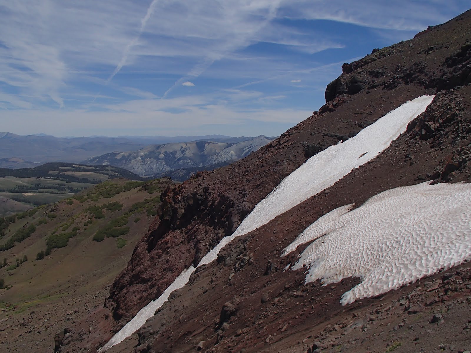
| Some lingering July snow up on the ridgeline |
 |
| Looking back on Sonora Pass after 2 miles of climbing up to a high plateau north of Leavitt Peak |


No comments:
Post a Comment