Near: South Lake Tahoe
Trip Type: Hike
Distance: 9 miles (from Armstrong Pass) or 15 miles (from Fountain Place)
Elevation: 7,600 - 10,900 feet
Surface: Smooth soft dirt mostly, rocky at the summit.
Vegetation: Forest mostly, shrub then moonscape near the summit.
Last Hiked: October 2015

Freel Peak is the highest spot in the Lake Tahoe Area. So clearly even the most casual peak bagger is going to have to climb it eventually. When you're the tallest thing for miles and miles near lake Tahoe, it goes without saying there are going to be a few nice views. Honestly, though, it's not the most exciting peak in the area. The peaks on the western shore of lake Tahoe are more dramatic and fun, and almost as high too. So make sure to hike those first. When you're looking for something new, or you want to do a massive trail run or mountain bike in the area, head out to Freel peak. Except for the summit spur, the trails are very smooth and gently ascending, and they're laid out with mountain bikes in mind.
Links:
Summitpost page for Freel Peak
Trailhead:
There are two obvious options for Freel Peak. Most folks with high clearance vehicles opt for the trailhead just below Armstrong Pass. We were in a Prius though, so we started at the lower, more distant trailhead at Fountain Place. I'm not sure where the name comes from, as we only saw a dead-end forest road there. Perhaps an old prospecting settlement. From highway 50 in South Lake Tahoe take Pioneer Trail (a non-descript side street) to Oneidas St and continues as Fountain Place Rd, a narrow but paved road that dead-ends at the Fountain Place trailhead.
The Route:
From Fountain Place you actually have two options: the maintained trail and a more direct use trail. We were up for a long day and didn't feel like coming to any route finding challenges so we played it safe and took the maintained trail. The use trail is supposed to stay on the north side of the stream and follow a creek up the the Tahoe Rim Trail at the saddle north of Freel Peak. Seems like it would be easy to navigate, but again we didn't try so I can't really say. Our route was a long, slow, but very steady ascent of over 3,000 feet on well graded mountain bike trails. Only after we left the Tahoe Rim Trail for the final ascent did it ever get steep and then only briefly. It was a very nice hike topped with sweeping views from a rocky summit. The shear length of the hike and thin air at the top made for a satisfying day, even if the terrain was less dramatic than some of the nearby peaks.
Caltopo Map:
http://caltopo.com/m/6CL3
 |
| The line here follows the route from Opencycle.org. Note it departs from the older route from Fountain Place on the NFS maps. The Opencycle route is the correct one. |

Pictures:
 |
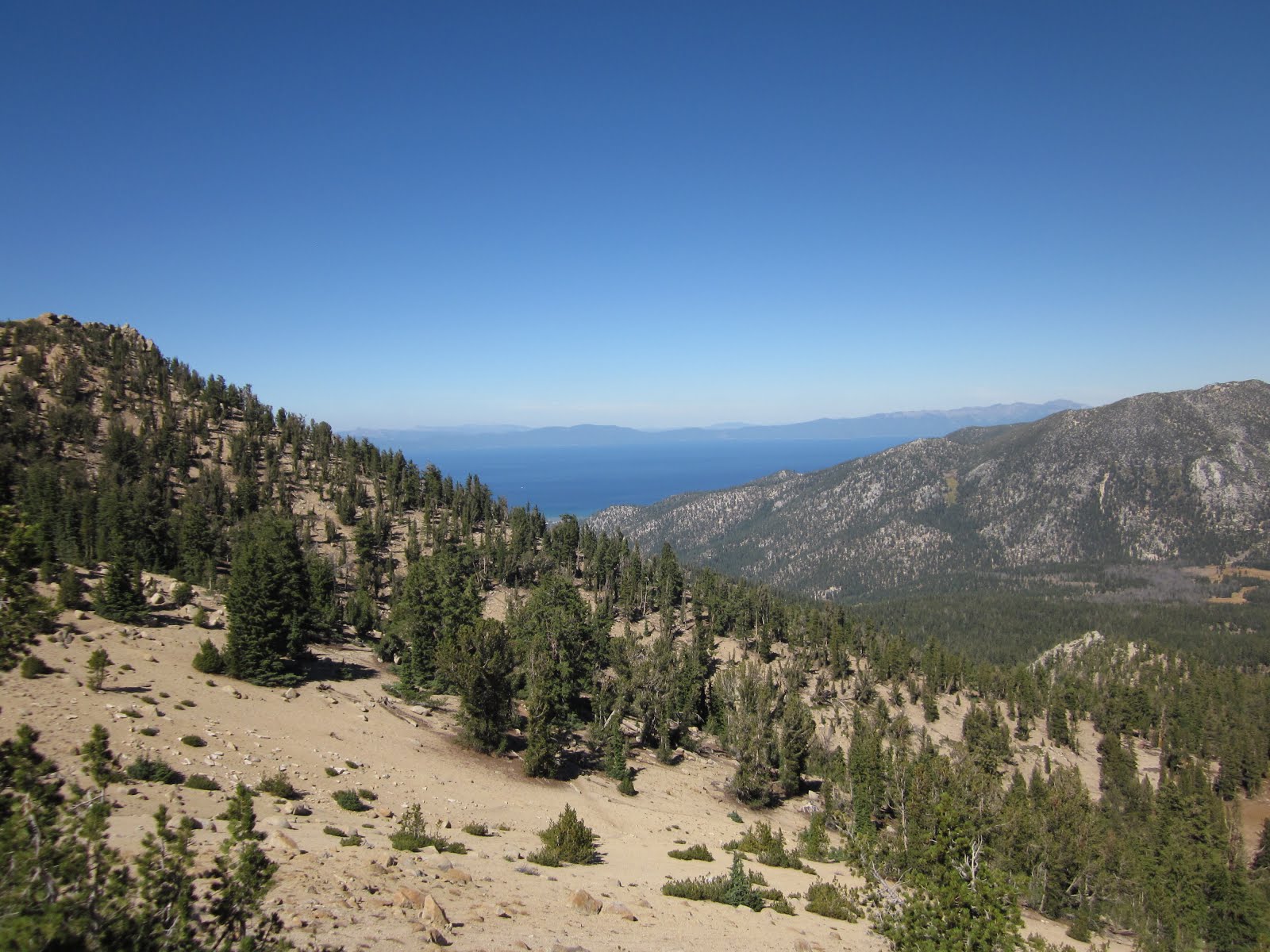
| First view of the lake from the north saddle. |
 |
| Looking south from the summit into Hope Valley. |

 |
| Tenacious tree, I salute you. |


No comments:
Post a Comment