Near: Mendocino
Trip Type: Hike
Elevation: 100 - 800 ft
Surface: Dirt
Distance: 2.5 miles
Vegetation: Redwoods

Links:
Article on th JSDF Trail Closures due to Sudden Oak Death BlightMore hikes in JSDF
Trailhead:
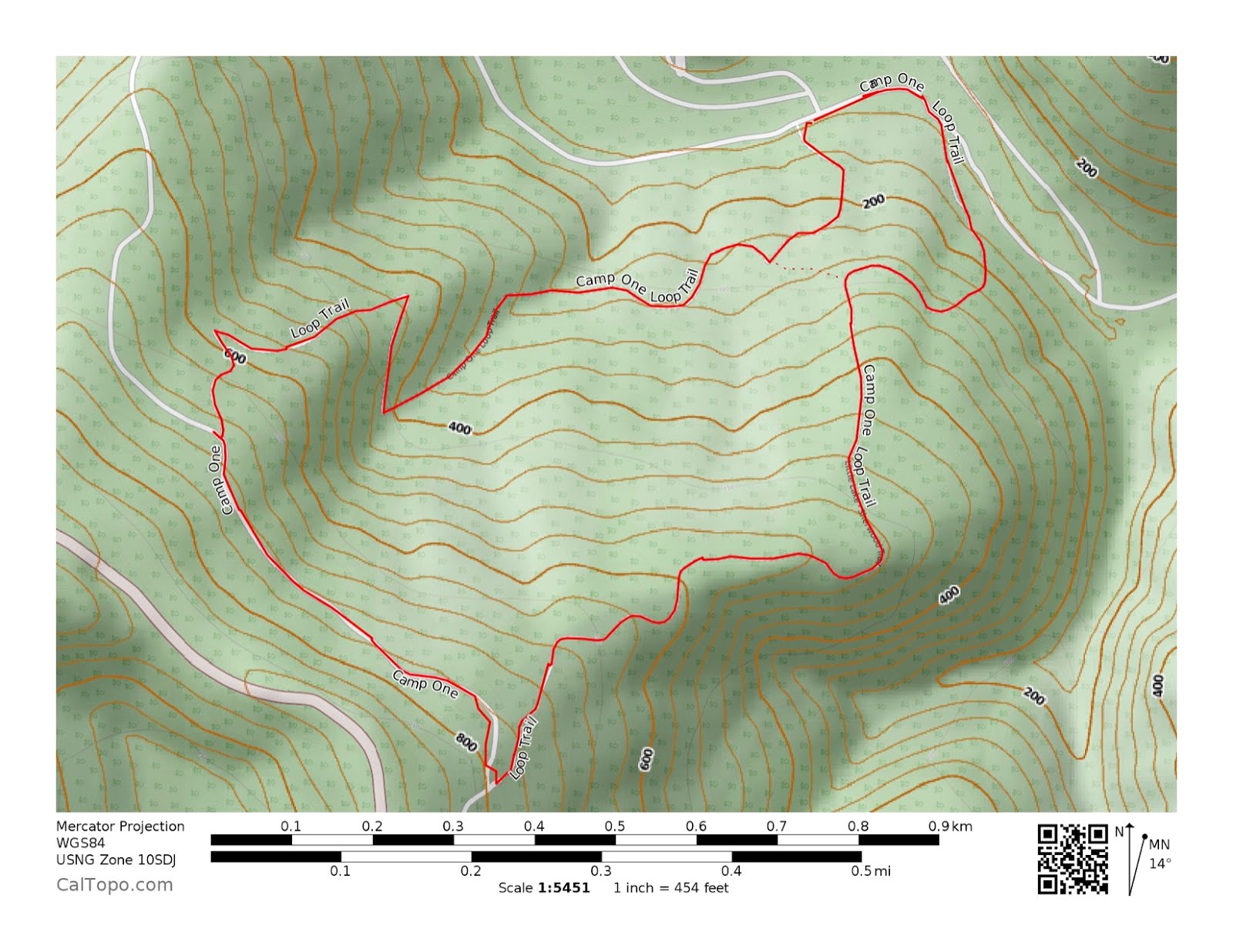
Camp One, Jackson State Demonstration Forest. Access road is about 5 miles east of Fort Bragg on CA-20. A small sign marks the access road that is on the slightly rough side of paved but should be no problem any car. There are several turnoffs, but they all seem to be gated, so Camp One is easy to find even though the access road seems to be missing from google maps and the interior roads in the JDSF seem to be mapped inconsistently on different sources. Amongst hiking apps, All Trails seems to have the best maps of JSDF. |
| Camp One Picnic Area |

The Route:
A short loop up the hill to an old logging road, then back down via another trail. We started on the eastern half of the loop (starts from the campground area just east of the parking area, past a gate on the road). We made it up to the road, but since we hadn't figured out where to find an accurate map of the loop and it's not well signed, we weren't sure if going down the road we get us anywhere. We took the connector trail down to the other trailhead (Just west of the parking area) and found a nice carved map of the trail that could have been more strategically placed. So it seem you can make a loop after all.
Access roads to the east and north from Camp One are gated for the wet season, but only block vehicle access, so the roads could make nice walking/bicycling/running routes as well.


Caltopo Map: http://caltopo.com/m/AEC0

No comments:
Post a Comment